Rivers & Lochs
In the north of AFT’s area there are several rivers flowing into Loch Etive that host salmon and sea trout populations. While the larger fisheries in the Rivers Etive, Kinglass and Awe have been monitored regularly, the Etive Rivers Project (2014) also undertook baseline fish and habitat surveys on most of the catchments including; The Esragan Burn, Allt Nathaise, The River Nant, River Noe, River Liver, Allt Easach and Abhainn Dalach.
Further North, Forestry and Land Scotland funded surveys of the local estates have funded on-going surveys and fishery improvement initiatives in the River Creran. Other coastal streams have also been surveyed to inform the development of renewable energy schemes.
In mid-Argyll, the rivers flowing into Loch Feochan (Nell & Euchar), Loch Melfort (Allt na Cille), Loch Craignish (Barbreck River) and Loch Crinan (River Add), AFT have conducted baseline and follow-up surveys of fish and fish habitats as part of the TWG initiative (2006-08). Further surveys have been undertaken through NEPS and to inform the development of renewable energy schemes.
The fish populations in the rivers flowing into the head of Loch Fyne have been surveyed regularly in the Rivers Array, Shira, Fyne and Kinglas since 2000 to inform local fishery management activities on behalf of the Loch Fyne Rivers Improvement Association (LFRIA). A wider survey of other rivers included the Douglas Water, Leacann Water, Strathlachlan, Allt Easach, Kilfinan and Auchalick as part of the Loch Fyne Rivers Project (2011-12).
Further south on the Cowal Peninsular and Firth of Clyde, the fish populations in the River Ruel (Loch Riddon), River Eachaig (Holy Loch) and Ardyne Burn have been surveyed as part of local fishery initiatives since 1998. A wider survey of fish habitat and fish populations of 17 rivers included the Loin Water, Croe Water, Finart Burn and River Goil was undertaken as part of the South Argyll Rivers Project (2008-09).
Baseline fish and fish habitat surveys were undertaken on 12 rivers on the Kintyre Peninsular (2005-06) as part of the Knapdale & Kintyre Rivers Project. The rivers surveyed in this project included the Claonaig Water, Carradale Water, Conieglen Water, Machrihanish Water, Barr Water and Ormsary Water. There have also been several surveys undertaken on other coastal streams to inform renewable energy projects.
The fish populations in seven rivers on the Isle of Mull were first surveyed as part of an Isles of Mull rivers Project in 2003, including the rivers Forsa, Aros, Bellart, Ba, Bunessan and Lussa. This survey was repeated in 2010 and included an eighth river: Mingary Burn. A wider picture of the island’s fish populations in coastal streams has been surveyed to inform renewable energy projects.
Baseline fish and fish habitat surveys were undertaken on 13 rivers on the island as part of the Isle of Arran Rivers Project (2008-09). The rivers surveyed in this project included the Iorsa Water, Machrie Water, Blackwater, Sliddery Water, Glenrosa Water and Chalmadale Water. There have also been several surveys undertaken on other coastal streams to inform renewable energy projects.
Further west on the southern end of the Hebridean Islands, the fish populations and habitats have been surveyed in nine catchments on the Isle of Islay (including the Rivers Laggan, Sorn and Kintour), three catchments on the Isle of Jura (including the Corran and Lussa Rivers) and several coastal streams on the isles of Coll and Colonsay as part of the Southern Hebrides Rivers Project (2012-13).
Maps of parts of our Areas of Operation

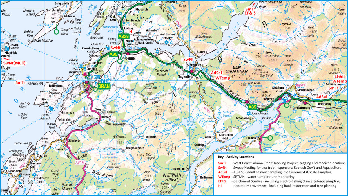
Click on the maps above to expand
Image Gallery of Argyll's Lochs & Rivers

Angling

Abhainn Shira in Winter

Auchengaich Burn, GlenFruin

Camloch Burn, Loch Long

Jura & Shuna

Leaping Salmon
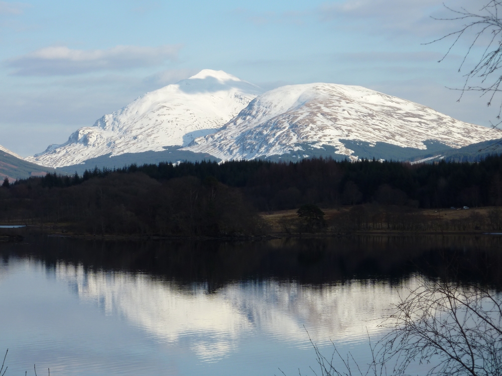
Loch Awe & Ben Lui

Loch Fyne & Arran

Loch Long

Loch Long
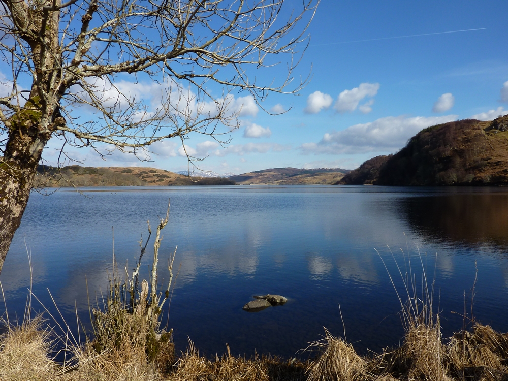
Loch Nell
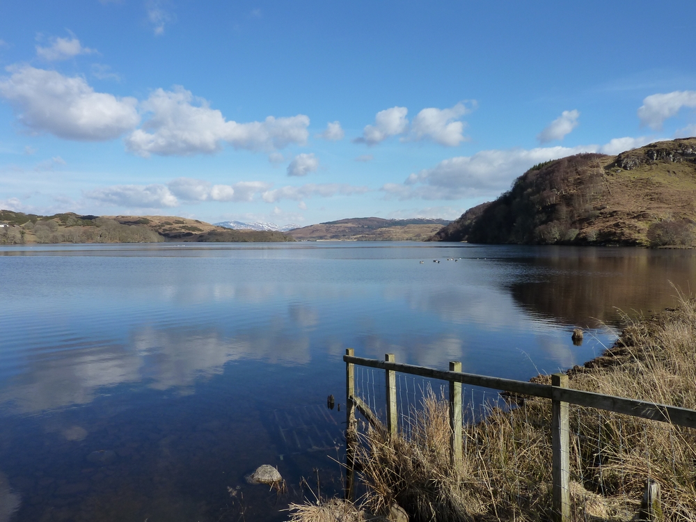
Loch Nell
Loch Eck

Loch Tulla in Winter

River Add near Crinan

River Feochan

River Kinglass & Ben Ime

River Orchy

River Orchy

River Orchy

River Orchy

River Orchy

River Orchy

River Orchy

River Orchy

River Orchy

River Orchy

River Aray in Winter

River Croe

River Eachaig

River Eachaig

River Finart

River Finart

River Finart

River Kinglass

River Kinglass

River Massan

Sound of Jura

Taynish